3D Laser Mapping crash investigations help reduce motorway congestion
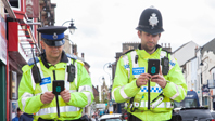
The use of laser scanners to collect vital data for crash investigations is set to drive down the £1 billion annual cost of congestion caused by collisions on motorways. An announcement by the Roads Minister Mike Penning of a £3 million fund for police forces to purchase laser scanning technology ensures Nottingham-based 3D Laser Mapping will continue to lead the way, having supplied one of the UKs largest road death investigation units with state-of-the-art laser scanners.

The use of laser scanners to collect vital data for crash investigations is set to drive down the £1 billion annual cost of congestion caused by collisions on motorways. An announcement by the Roads Minister Mike Penning of a £3 million fund for police forces to purchase laser scanning technology ensures Nottingham-based 3D Laser Mapping will continue to lead the way, having supplied one of the UKs largest road death investigation units with state-of-the-art laser scanners.
In regular use, the Riegl VZ-400 laser scanner has been proven to reduce the time spent collecting evidence at the scene, can be operated in all conditions and is being used to produce high-quality graphics and detailed plans of collision scenes for use in court.
The Riegl VZ-400 supplied by 3D Laser Mapping has been proven to provide a significantly greater level of detail and colour compared to other laser scanners and can be used during the day, evening in low light conditions and at night. The VZ-400 was also significantly faster than other devices. Comparison of the Riegl with total station surveying, widely used by police forces across the country, identified an onsite time saving in the region of 50 per cent. This can in turn be converted into a reduction in road closure times by an average of 1.5 hours.
Dr Graham Hunter, managing director of 3D Laser Mapping, commented: Laser scanning has been proven to offer significant advantages over more traditional survey techniques for crash investigation. Using the Riegl VZ-400 it is possible to collect more data, of a higher level of accuracy, in a shorter period of time and in adverse conditions. This directly translates into a reduction in road closure time which in turn can be converted into a multi-million pound saving for the UK economy.
The VZ-400 utilises unique echo digitisation and online waveform analysis to achieve accuracies of measurement, even under adverse weather conditions. Achieving accuracies of 5mm at ranges of up to 600m (an increase of 100m on earlier models) the VZ-400 can measure up to 122,000 points per second with a 100 x 360-degree field of view. The evaluation of multiple targets combined with a reliable, robust and lightweight construction makes the VZ-400 ideally suited to civil engineering, city modelling and architectural projects, for example.
3D Laser Mapping Ltd
Contact: Dr Graham Hunter
Email: graham@3dlasermapping.com
Tel: +44 (0) 870 442 9400
Web: www.3dlasermapping.com